
A tide table tells you when the sea will be at its highest and lowest on a given day, and how high it will reach. To use one, find your nearest port, check the date, note whether the page is in GMT or British Summer Time, then plan to be off anything that floods well before the next high water.
That sounds simple, and the people who study this suggest it is less so in practice. A Bangor University project with the RNLI found that over a quarter of the British and Irish public struggled with a basic tide table, and that only a quarter could draw more complex information from one. People also tended to overrate their own ability. So it is worth ten minutes at the kitchen table before the holiday, not on the sand.
The four numbers on the page
Most ports around Britain have two high waters and two low waters a day, which the National Tidal and Sea Level Facility calls a semi-diurnal regime. A table therefore usually gives four rows for each date, each with a time and a height.
- HW or high water: the top of the tide. Your cut-off risk is greatest in the hours before this.
- LW or low water: the bottom of the tide, when the most beach is showing.
- Height: in metres. On the UK Hydrographic Office's Admiralty EasyTide service these are metres above Chart Datum, a fixed reference level, and not the depth of water where you happen to be standing.
- Range: not printed, but you can work it out by subtracting low water height from high water height. A big range means a lot of water has to move in the same time.
EasyTide gives predictions for the next seven days, and the National Tidal and Sea Level Facility publishes predictions for selected ports for 28 days. Both are free to read. Admiralty is explicit that EasyTide must not be used by vessels for navigation, so anyone taking a boat out needs proper nautical publications.
A worked example, with invented figures
The figures below are made up to show the method. Do not plan anything around them.
| Tide | Time | Height |
|---|---|---|
| Low water | 05:30 | 0.7m |
| High water | 11:40 | 5.6m |
| Low water | 17:55 | 0.9m |
| High water | 00:10 (next day) | 5.4m |
Say you want to walk round a headland in the afternoon. The falling tide from 11:40 to 17:55 gives you the window, and you want to set out while the water is still dropping and be back well before it has climbed far. Low water at 17:55 tells you the sea turns around about then, so a start in the mid-afternoon and a return by early evening is the shape of the plan. A walk that begins at 18:30 has it backwards, because every minute you are out, the way back gets narrower.
The tide does not move at a steady speed, and this is where people get caught. The old rule of twelfths, a rough approximation of the curve, says that over the six hours or so between low and high water the level changes by one twelfth in the first hour, two in the second, three in the third, three in the fourth, two in the fifth and one in the last.
In our example the range on the falling tide is 4.7m, so a twelfth is about 0.4m. In the third and fourth hours alone the water drops about 2.4m, half the whole range. The same happens on the way back up. The sea looks almost still around high and low water, then moves quickly in the middle, which can make a slow start to the flood badly misleading.
Why the times move each day
High tides in UK waters come roughly every 12 hours 25 minutes, because the same spot on Earth takes about 24 hours 50 minutes to line up with the moon again. The practical result is that the tide you enjoyed at lunchtime on Monday will be meaningfully later by Wednesday. Yesterday's plan does not carry over to today, and a table for last week tells you nothing useful.
Heights change too. Spring tides, which have nothing to do with the season, come one to two days after a new or full moon, with higher highs and lower lows. Neap tides, around the moon's quarters, have a smaller range. The cycle runs twice a month. On springs a beach can be vast at low water and then gone altogether at high water, so a route that was fine on a neap may flood on a spring.
The mistakes worth avoiding
- Using the wrong clock. EasyTide lets you choose GMT or GMT+1, and warns that a chosen view does not switch itself back at the end of British Summer Time. Published tables vary, so check the small print for which one you are reading. An hour's error is enough to ruin the plan.
- Using a port some way off. Times and heights differ along the coast. Pick the nearest station you can find, and ask locally if yours is listed as a secondary point.
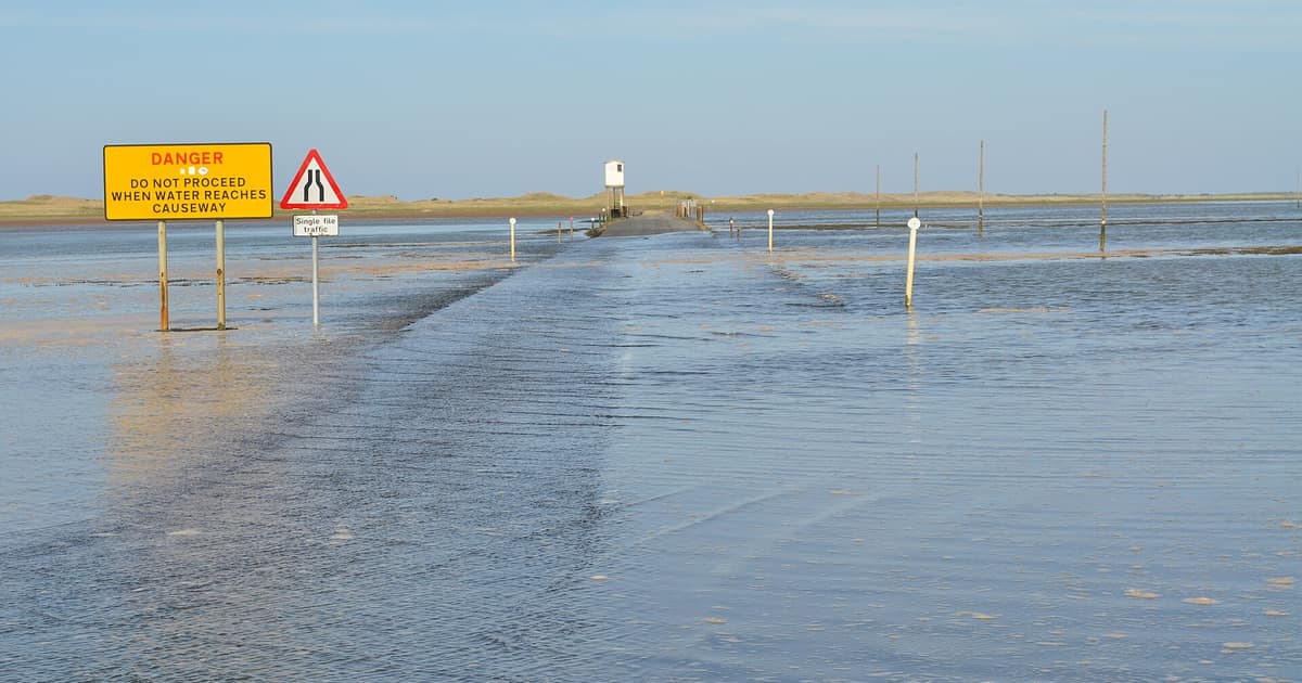
- Assuming the water comes straight at you. The Bangor researchers found that people picture a slow line moving up the beach. In reality the tide often runs sideways first, along channels and around sandbanks, and can cut off your route behind you before your feet are wet.
- Ignoring the weather. A table is an astronomical prediction. Storm surges, driven by wind and air pressure, can push the sea above it, and they can only be forecast about two to five days ahead. Southampton-style double high waters are another local quirk: at some ports the tide simply does not follow the textbook curve.
- Trusting a harbour photograph. Plenty of pretty harbours, such as those on our list of towns you can reach by train, dry out at low water and look like another place six hours later.
If the water gets round you
HM Coastguard's advice is to explore on a falling tide, know where the exits from a bay are, carry a charged phone and tell someone when you expect to be back. The water depth at some UK locations can change by as much as 10 metres between tides.
Once you have read a table a couple of times it becomes habit, like checking a train time. It also makes the coast more interesting. You start to notice which steps are weeded and which are dry, and how far up a harbour wall the last high water reached. If you are hunting along the strandline, low water on a spring tide is also when the most beach is showing, which is handy if you have read what you may and may not take home.
Sources opened for this entry
- National Tidal and Sea Level Facility: tides questions and answers
- National Tidal and Sea Level Facility: high and low water times
- Admiralty EasyTide (UK Hydrographic Office)
- HM Coastguard: coastal safety
- Bangor University: why people get cut off by the tide
Links last checked 8 November 2026. Rules, figures and timetables change, so follow the source for the current position.